Trimble GNSS Systems


Backed by a legacy of GNSS technology leadership and surveying expertise, Trimble provides surveyors and GIS professionals with reliable, innovative GNSS survey solutions that meet their distinct requirements.
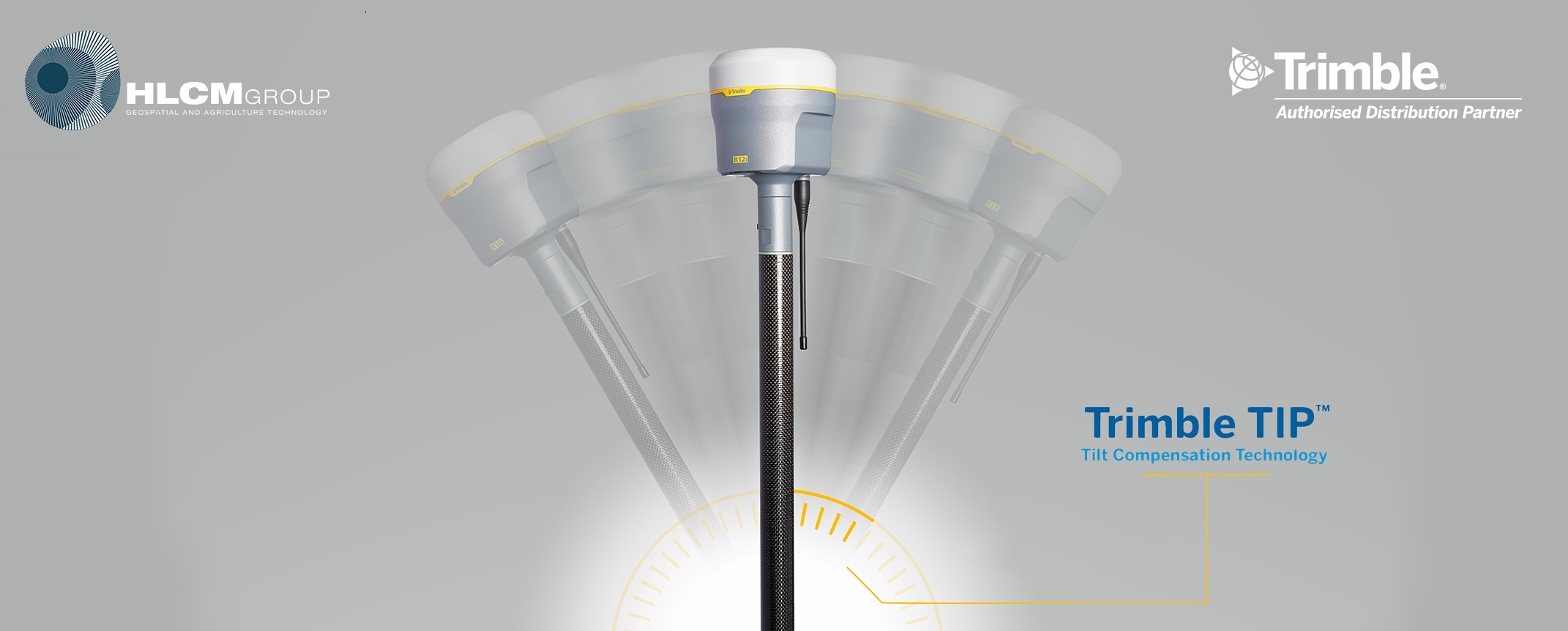
Trimble R12i

Trimble R12i GNSS Receiver

A new angle of productivity

  • Real time kinematic: 8 mm H / 15 mm V
  • TIP positioning performance: RTK + 5 mm + 0.4 mm/° tilt
  • CenterPoint RTX precision: 2 cm H / 5 cm V
  • Wideband UHF radio: Up to 2 Watt Tx
  • Lightweight: 1.12 kg
  • Compact: 11.9 cm x 13.6 cm
  • Learn more about the R12i
  • Download the R12i Datasheet (PDF, Eng-US, 901 KB)

Trimble R12

Trimble R12 GNSS Receiver

Push the boundaries of GNSS performance

  • Real time kinematic: 8 mm H / 15 mm V
  • CenterPoint RTX: 2 cm H / 5 cm V
  • 672: GNSS channels
  • Wideband UHF radio: Up to 2 Watt Tx
  • Lightweight: 1.12 kg
  • Compact: 11.9 cm x 13.6 cm
  • Learn more about the R12
  • Download the R12 Datasheet (PDF, Eng-US, 479 KB)

Trimble R780

Trimble R780 GNSS Receiver

Freedom to work your way.

  • Configurations: Base & rover, rover or base
  • Real-time kinematic: 8 mm H/15 mm V
  • TIP positioning performance: RTK + 8 mm + 0.5 mm/° tilt
  • CenterPoint RTX: 2 cm H/5 cm V
  • Ultra-rugged: IP68/MIL-STD-810G
  • UHF Radio: Receive & Transmit
  • Learn more about the R780
  • Download the R780 Datasheet (PDF, Eng-US, 682 KB)

Trimble R580

Trimble R580 GNSS Receiver

Proven, reliable positioning.

  • 10 mm H/20 mm V: Maximum precision
  • 2 cm H/5 cm V: CenterPoint RTX precision
  • Quick setup: One-button start-up and cable-free
  • 450 MHz: UHF radio (receive only)
  • IP65/MIL-STD: Ruggedness
  • iOS, Android, Windows 10: Platform support
  • Learn more about the R580
  • Download the R580 Datasheet (PDF, Eng-US, 728 KB)

Trimble R4sLE

Trimble R4sLE GNSS Receiver

The alternative to a total station.

  • Designed for forensics, by forensics experts.
  • Multiple connection options: RTK, Trimble RTX, Base-rover
  • High precision: 8mm H / 15mm V precision
  • Rugged system: Waterproof and impact resistant
  • Seamless software integration: Collect and store data in Capture
  • Easy to setup: No need for a tripod
  • Work untethered: RTX and Base-rover to work offline
  • Learn more about the R4sLE
  • Download the R780 Datasheet (PDF, Eng-US, 156 KB)

View all GNSS Systems* on the Trimble Logo linked to website geopatial webpage

*Modular GNSS Systems, Catalyst GNSS Systems, Handheld GNSS Systems, Data Radios, Antennas, GNSS Accessories


Trimble Total Stations


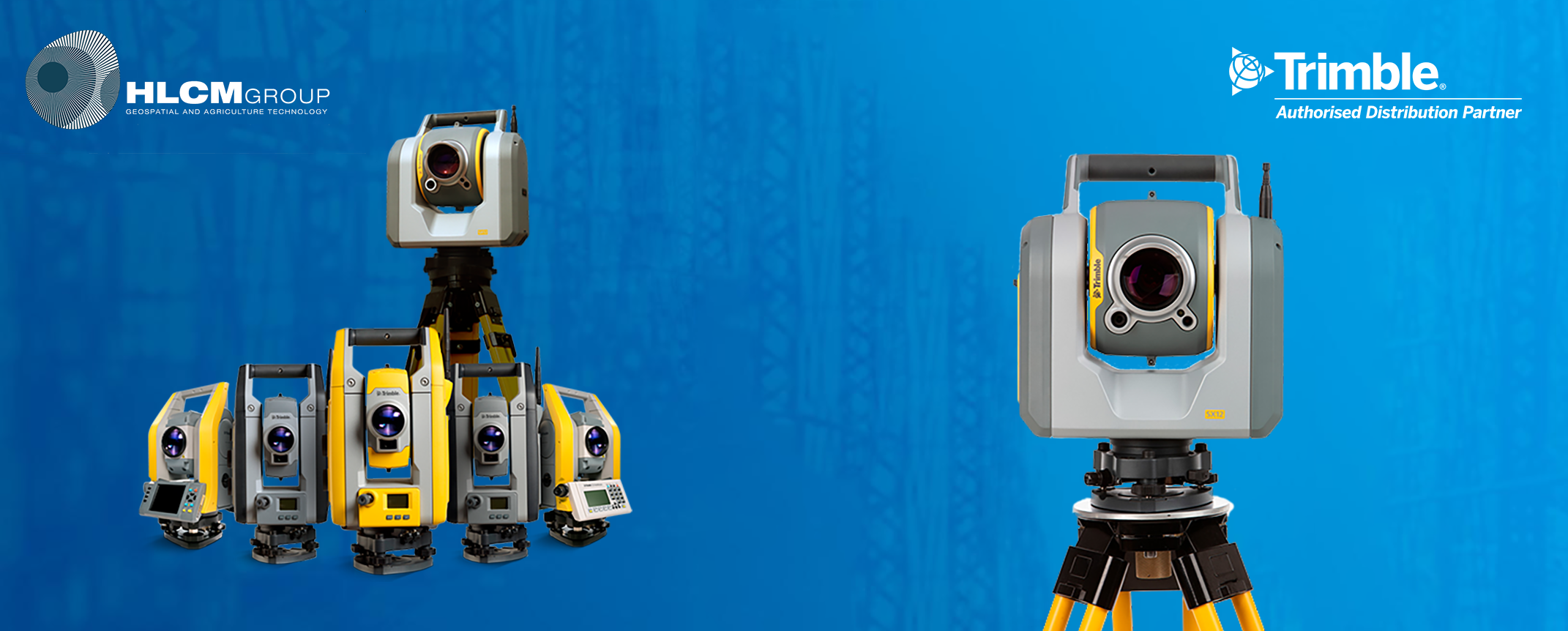
Land surveying equipment and total station solutions to meet your optical and conventional surveying needs. Find the Mechanical, Servo with Autolock, ActiveTrack, Robotic, or Scanning Total Station that suits your project.

Trimble SX12

Trimble SX12 Total Station

Collect survey data, VISION™ imagery, and high-speed scans easily

  • High accuracy total station, high quality scan data

  • - 1" angular accuracy

  • - 1.5 mm scan range noise at 200 m

  • - 14 mm diameter EDM laser spot at 100 m

  • Quick data capture, even at long range

  • - 26.6 kHz scan measurement rate, up to 600 m

  • - 1.6 s total station measuring time in prism mode

  • - 1.2 s total station measuring time in DR mode

  • Vivid, eye-safe laser pointer

  • - Green and focusable, this laser pointer is exceptionally small, bright, and still eye safe

  • - 3 mm diameter laser pointer spot at 50 m

  • Simple navigation and documentation with Trimble VISION™ camera system

  • - Three integrated and calibrated cameras in the telescope

Trimble S7

Trimble S7 Total Station

Delivers enhanced scanner performance with fewer instrument setups

  • Robotic Total Station

  • Angular Accuracy: 1", 2", 3", or 5"

  • EDM Technology: DR PLUS

  • EDM Accuracy: 1.0 mm + 2 ppm Prism / 2.0 mm + 2 ppm DR

  • MagDrive, for exceptional speed and accuracy, reduce wear and tear, and smooth, silent operation

  • FineLock, which detects targets without interference from surrounding prisms, ensuring target lock over long distances, and eliminating errors caused by interference

  • SurePoint, ensures precise pointing and measuring by staying on target through virtually any situation, from windy weather to vibrations

  • L2P technology and InSphere Equipment Manager

  • Industry-leading field and office software for fast data collection and processing no matter the Trimble instrument

Trimble S5

Trimble S5 Total Station

Count on the Trimble S5 total station to make your job easier, day after day

  • Everything you need to perform survey campaigns

  • Angular Accuracy: 1", 2", 3", or 5"

  • EDM Technology: DR PLUS

  • EDM Accuracy: 1.0 mm + 2 ppm Prism / 2.0 mm + 2 ppm DR

  • Measure further and faster with the Trimble DR Plus EDM

  • Trimble L2P real-time equipment management

  • Seamless integration with the Trimble V10 Imagine Rover and GNSS receivers

  • Intuitive Trimble Access Field Software

  • rimble Business Center Office Software for quick data processing

Trimble C5

Trimble C5 Total Station

Tough, Durable and Easy to Use. The efficient, accurate way to work

  • Autofocus enabling precise and fast focus

  • Accuracy: 1", 2", 3", or 5"

  • EDM Accuracy: 2.0 mm + 2 ppm Prism / 3.0 mm + 2 ppm DR

  • Range 5,000 m to prism / DR 800 m

  • Powerful long range EDM

  • Dual color touchscreen displays

  • L2P security location technology

  • Compact, lightweight and rugged system design

  • Onboard Software: Trimble Access

  • Winterized 2" and 5" models available

View all Total Stations* on the Trimble Logo linked to website geopatial webpage

*Total Stations (Scanning, Robotic, Autolock, Mechanical), Optical Accessories.


Trimble Mobile Mapping


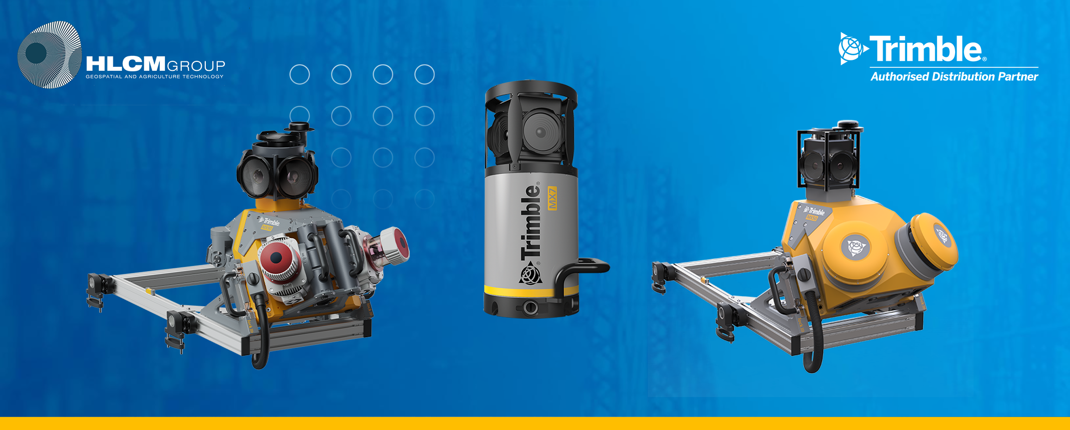
Trimble's premium vehicle-mounted mobile spatial imaging systems integrate their industry leading geo-referencing technologies with very precise, high-speed laser scanning and high-resolution imaging sensors so you can rapidly collect enormous amounts of highly accurate, geo-referenced spatial data and transform it into information-rich 3D models.

Trimble MX90

Trimble MX90

For large-scale scanning and mapping missions

  • Weight: Sensor unit 37 kg

  • IP rating: Sensor unit IP64

  • Spherical camera: 72 MP (6 X 12 MP)

  • Planar cameras: 2 X 12 MP side facing, 1 X 12 MP backward/downward facing

  • Laser effective measurement rate: Up to 3.6 MHz

  • Scan speed: 500 scan/sec

  • Embedded Trimble GNSS-inertial system: Trimble field-to-finish workflow

  • Road and rail assets

  • Telecommunication asset inventories

  • Elevation models

  • Volumetric analyses

  • 3D city models

  • As-Built surveys

Trimble MX50

Trimble MX50

Mobile scanning and imaging for asset management

  • Weight: Sensor unit 23 kg

  • IP rating: Sensor unit IP64

  • Spherical camera: 30 MP (6 X 5 MP)

  • Laser effective measurement rate: Up to 960kHz

  • Scan speed: 240 scan/sec

  • Embedded Trimble GNSS-inertial system: Trimble field-to-finish workflow

  • Highway assets

  • Utility assets

  • City assets

  • Accurate ground models

  • Engineering profiles and cross-sections

  • Road surface information

Trimble MX7

Trimble MX7

Mobile imaging for asset management.

  • Weight: Sensor unit 11.3 kg

  • IP rating: Sensor unit IP65

  • Spherical camera: 30 MP (6 X 5 MP)

  • Field of view: 90% of full sphere

  • Scan speed: 240 scan/sec

  • Embedded Trimble GNSS-inertial system: Trimble field-to-finish workflow

  • Geo-located immersive panoramic images

  • GIS data capture, extraction and maintenance

  • City maps & models

  • Change analyses over tim

  • Road asset inventories

  • Telecommunication asset inventories

  • Visual pavement condition assessment

Trimble Data Collectors

Controllers


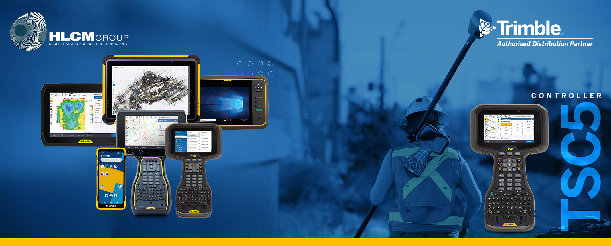
Whether you need a fully integrated GNSS handheld for GIS data collection and maintenance, or a field controller to pair with your GNSS receiver and total station for survey work, Trimble has a range of high performing, rugged field devices that provide everything from centimeter accuracy to communications and more.

Trimble TSC7

Trimble TSC7 Controller

Big screen with giant potential

  • Large 7-inch multi-touch screen for finger or stylus
  • Secure Windows® 10 Pro operating system
  • Manages large project files, complex imagery, point clouds, and other 3D data
  • Intel Pentium processor with 8 GB RAM and 64 GB internal memory
  • Front- and rear-facing cameras for evidence photo collection
  • Backlit keypad with customizable button commands to ensure visibility in the toughest conditions
  • Military-spec rugged design, engineering and performance
  • Learn more about the TSC7
  • Download the TSC7 Datasheet (PDF, Eng-US, 381 KB)
  • Download the TSC7 User Guide (PDF, Eng-US, 2.0 MB)

Trimble TSC5

Trimble TSC5 Controller

Every Day Extraordinary

  • Back-lit international alphanumeric keypad with directional keys
  • Function, Shift and AGr key combinations
  • Ergonomic design, easy to grip and carry, less handling fatigue
  • All day battery, with user-replaceable battery option
  • 5-inch multi-touch screen—with finger, stylus and glove modes
  • Bright, anti-glare display, readable in sunlight and lowlight conditions
  • Military-spec rugged design, IP65 rated
  • Android™ 10 operating system
  • Learn more about the TSC5
  • Download the TSC5 Datasheet (PDF, Eng-US, 189 KB)
  • Download the TSC5 User Guide (PDF, Eng-US, 2.5 MB)

Trimble TDC6

Trimble TDC6 Handheld Controller

Versatility in the field - Flexibility for your workflow

  • 287 g/10 oz: Lightweight, slim form factor
  • Android™ 12 operating system
  • Worldwide 5G: Integrated cellular data
  • 9 hour battery life: Easy battery hot-swapping
  • 6.3 inch screen: Sunlight readable display
  • IP67/MIL-STD-810G: Rugged and durable
  • Learn more about the TDC6
  • Download the TDC6 Datasheet (PDF, Eng-US, 935 KB)
  • Download the TDC6 User Guide (PDF, Eng-US, 1.4 MB)

Tablets


Trimble T100

Trimble T100 Handheld Controller

Depend on it

  • Fast and powerful processor, for efficient data collection and data processing
  • Windows® 10 brings the office to the field
  • Large 10.1-inch touchscreen, sunlight readable and wet weather efficient with a high resolution display
  • Ergonomic design that’s comfortable and portable on long demanding days in the field
  • Expandable Trimble® Empower modules, provide flexibility for user configurations
  • Learn more about the T100
  • Download the T100 Datasheet (PDF, Eng-US, 189 KB)
  • Download the T100 User Guide (PDF, Eng-US, 1 MB)

Trimble T10x

Trimble T10x Handheld Controller

Push the limits of productivity.

  • Large 10.1 inch screen: easy viewing of data
  • Capacitive touch screen: Enhanced map interaction
  • Built tough: IP-65 and MIL-STD-810H ruggedness certification
  • WiFi and Bluetooth: Integrated connectivity
  • Li-Ion batteries: Long life and hot-swappable
  • Intel 13th Generation Core™ i7: High performance processor
  • 1 TB Storage and 32 GB RAM
  • Learn more about the T10x
  • Download the T10x Datasheet (PDF, Eng-US, 463 KB)
  • Download the T10x User Guide (PDF, Eng-US, 1.8 MB)

Trimble T7

Trimble T7 Handheld Controller

Perfectly sized for any geospatial application.

  • 7-inch multi-touch screen: Use with finger or stylus.
  • Large 8 GB memory: Quick data input and easy processing.
  • Dual expansion slots: For interchangeable Empower modules.
  • Rugged design: Performs in all conditions.
  • Optimized to run Trimble field software: Trimble Access & Trimble TerraFlex.
  • Bright outdoor readable display: Manipulate and easily view maps.
  • Learn more about the T7
  • Download the T7 Datasheet (PDF, Eng-US, 335 KB)
  • Download the T7 User Guide (PDF, Eng-US, 5.6 MB)

View all Data Collectors* on the Trimble Logo linked to website geopatial webpage

*Modular GNSS Systems, Catalyst GNSS Systems, Handheld GNSS Systems, Data Radios, Antennas, GNSS Accessories


Trimble 3D Laser Scanners


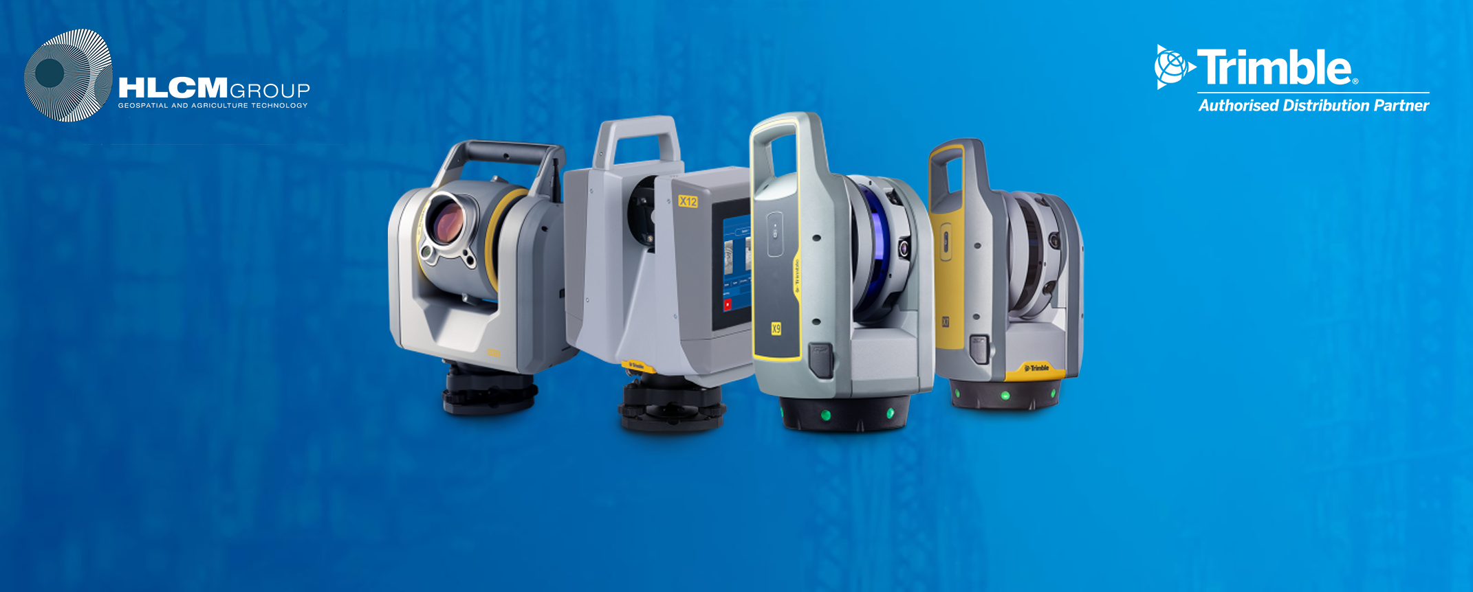
Trimble’s advanced 3D scanning systems let you scan with the confidence and produce results you can trust. Whether you’re doing a topographic survey, capturing as-builts, performing comprehensive data analysis, new construction or a renovation model, Trimble solutions empower quick and accurate scanning, registration and creation of comprehensive deliverables.

Trimble X12 Scanner

Trimble X12 Scanner Total Station

Accessible scanning and imaging with superior speed, accuracy, range, and quality

  • Scan up to an astonishing 2.18 million points per second with a range of 365 meters.

  • Range noise of 0.2 mm and density of 0.6 mm at 10 meters.

  • Full dome scans as fast as 23 seconds, complemented with the ability to quickly and efficiently scan areas of interest at high quality settings.

  • A minimum scan range of 0.3 meters, allowing you to capture more detail in tight spaces.

  • Experience breathtaking colorization of your point cloud data with parallax free images.

  • Smart light, LED spotlights of 700 lumen improve image acquisition in poor light conditions and even completely dark environments.

  • Topographic/General Surveys

  • Civil Infrastructure

  • Industrial Survey

  • Forensics

  • Cultural Heritage

  • Digital Twin

  • Tank Calibration & Inspection

  • Shipbuilding Surveys

Trimble X9 Scanner

Trimble X9 Scanner Total Station

Versatile advanced scanning and imaging you can depend on.

  • Simple and efficient field workflows suitable for all users.

  • Powerful Trimble® Perspective software to easily manage and validate projects in the field with auto-registration

  • Smart auto-calibration and selfleveling optimized to increase productivity and function

  • Laser pointer for georeferencing and single point measurements

  • High sensitivity with all scan modes to capture dark and shiny surfaces fast

  • Trusted auto-calibration and survey grade self-leveling for dependable data quality.

  • Topographic surveys

  • General surveys

  • Civil infrastructure

  • Industrial survey

  • Forensics

  • Culteral Heritage

  • Digital twin

  • Tank calibration & inspection

  • Ship building surveys

Trimble X7 Scanner

Trimble X7 Scanner Total Station

Delivers Powerful Performance with Simple Operation

  • Automatic Calibration: Complete confidence in every scan with the industry's first smart calibration system. No targets or user interaction required. On-Demand calibration reports

  • Trimble Registration Assist: Increase your field productivity with the industry's most comprehensive automatic registration

  • Laser Pointer: Provide visual confirmation of individual points to be measured by Trimble Perspective

  • Georeferencing: Link registered scans to a project coordinate system in Trimble Perspective

  • Quick data capture, even at long range

  • Civil infrastructure

  • Industrial survey/tank calibration

  • General surveys

  • Road intersection surveys

  • Forensics

  • Utilities

  • Mining

  • Historical documentation and renovation

Trimble SX12

Trimble SX12 Total Station

Collect survey data, VISION™ imagery, and high-speed scans easily

  • High accuracy total station, high quality scan data

  • - 1" angular accuracy

  • - 1.5 mm scan range noise at 200 m

  • - 14 mm diameter EDM laser spot at 100 m

  • Quick data capture, even at long range

  • - 26.6 kHz scan measurement rate, up to 600 m

  • - 1.6 s total station measuring time in prism mode

  • - 1.2 s total station measuring time in DR mode

  • Vivid, eye-safe laser pointer

  • - Green and focusable, this laser pointer is exceptionally small, bright, and still eye safe

  • - 3 mm diameter laser pointer spot at 50 m

  • Simple navigation and documentation with Trimble VISION™ camera system/li>
  • - Three integrated and calibrated cameras in the telescope/li>
  • Boundary and Land Title Surveys

  • Topo, Stakeout, and Surface Inspection

  • Underground Mine Survey

  • Roadway/Corridor Surveys

  • Civil Infrastructure as-builts

  • As-Built surveys

Trimble Forensics


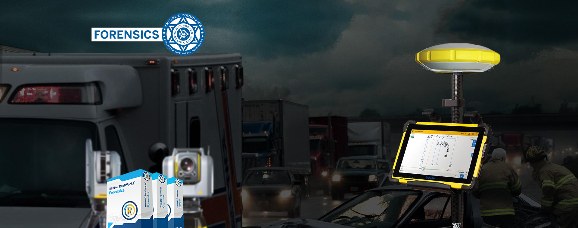
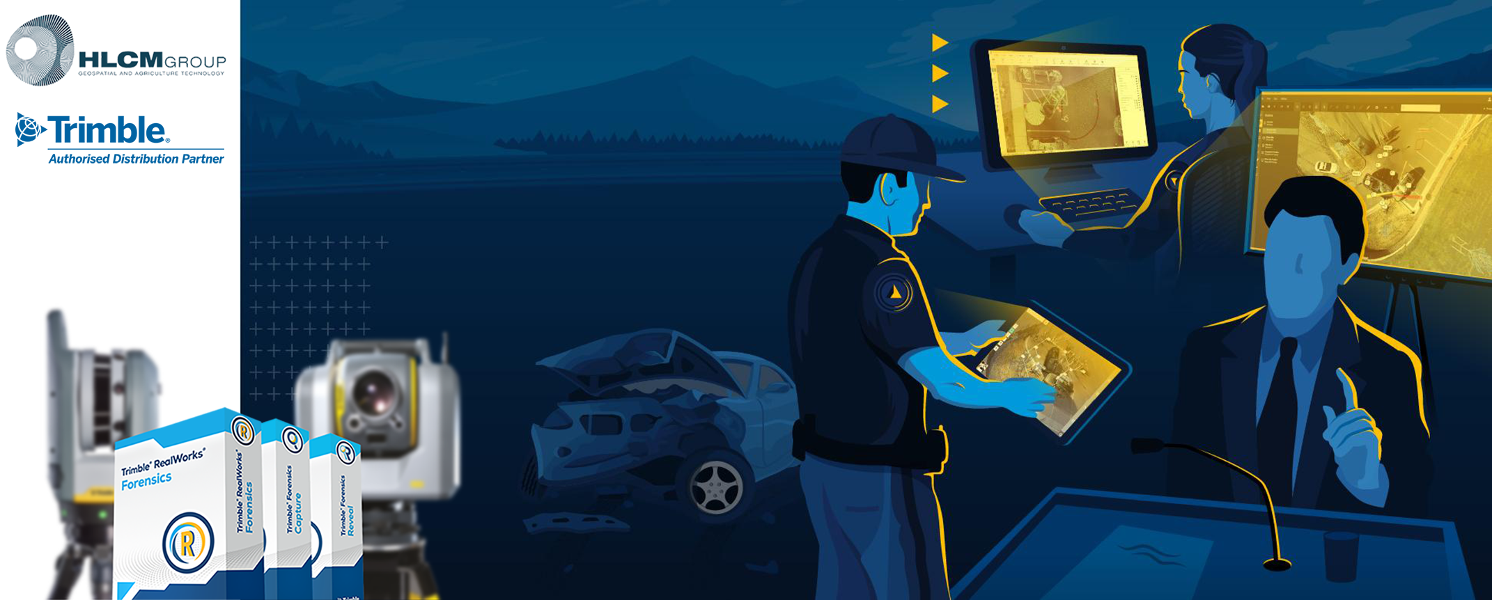
Your reputation is dependent on producing high quality and compelling deliverables, as efficiently as possible. Trimble Forensics software solutions expedite the processing of field data and streamline your workflows, enabling you to quickly generate quality results with confidence.

Forensics Capture

Forensics Capture Software

Powerful, Seamless Simplicity

  • View and edit in 2D or 3D
  • Seamless integration with Trimble Reveal
  • Robotic total station support
  • Built-in point cloud libraries
  • Radio bridge connectivity
  • Bluetooth connection capabilities
  • New and improved UI
  • Up-to-date Android operating system
  • Email sharing
  • Evidence marker system with support for photos
  • Touch controls; no need for a stylus
  • Distance measurements between points
  • Easy import options for Trimble Reveal
  • Learn more about the Forensics Capture
  • Forensics Capture Datasheet (PDF, Eng-US, 1.3 MB)
  • Forensics Capture User Guide (PDF, Eng-US, 1.8 MB)

Forensics Reveal

Trimble Forensics Reveal Software

Quick, Easy to Use, and Efficient

  • Import point clouds with the laser scan module
  • View and edit in 2D or 3D
  • SketchUp 3D Model Warehouse support
  • SmartRooms (quick buildings)
  • 2D and 3D Animation
  • Multiple sources for vehicle specifications (4N6Experts, Canadian Vehicle Specifications)
  • Damage vehicles using 6/12 point crush, total station measurements,or “freehand”
  • Evidence marker system with support for photos
  • Drag factor/acceleration analysis
  • Momentum analysis
  • Bullet trajectory analysis
  • CrashMath (reconstruction equation solver)
  • Learn more about the Forensics Reveal
  • Forensics Reveal Datasheet (PDF, Eng-US, 1.0 MB)
  • Forensics Reveal User Guide (PDF, Eng-US, 2.2 MB)
  • Forensics Reveal Edition Comparison (PDF, Eng-US, 213 KB)

Forensics Showcase

Trimble Forensics Showcase Software

Photo-realistic Visuals for the Courtroom

  • Simple, easy-to-use and lightweight application designed by law enforcement professionals for you to present your testimony in chronological order
  • Create custom 360-degrees viewpoints of your Reveal scene for courtroom presentation
  • Customize your testimony by adding highlights around key evidence or areas of interest
  • Easy import of your evidence and attachments from your Reveal software
  • Supplement your scene with added capability to attach evidence images, videos, reports etc
  • Easy to share your scene with peers and attorneys securely for courtroom preparation
  • Learn more about the Forensics Showcase
  • Forensics Realworks Datasheet (PDF, Eng-US, 657 KB)

Forensics Realworks*

Trimble Forensics Realworks Software

Point cloud processing and compelling deliverables

  • Automated tools for registration and point cloud cleanup
  • Import data collected with virtually any laser scanner, including processed UAV data (.las format)
  • Manage, process and analyze large datasets
  • Export to Trimble Forensics Reveal
  • Learn more about the Forensics Realworks
  • Forensics Realworks Edition Comparison (PDF, Eng-US, 61 KB)
  • *Works with Trimble Forensics Capture

View all information and resources about Trimble Forensics at Trimble Logo linked to website

*Software, Data Collectors, Total Stations, Laser Scanning, GNSS.


Geospatial Products and Services